Toxin Distribution Charts
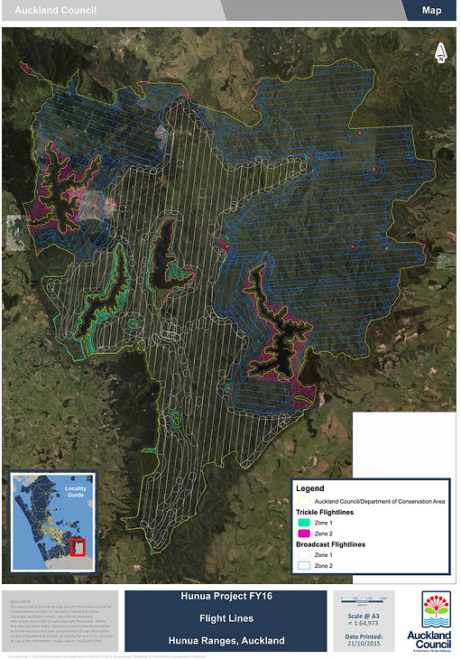
The following Official Toxin Distribution Charts are a selection from dozens of aerial operations that take place every year in New Zealand. The charts show exactly where 1080 poison bait is spread. In most operations, the poison bait is dropped directly into all running water at the same rate as the land areas. See below to view the charts.
Please note - The toxin distribution charts can be obtained for any aerial poisoning operation by sending an email to the Department of Conservation - oia@doc.govt.nz - quoting the operation you want the chart for. If the drops are by TBFree or regional councils, just make contact and quote the Official Information Act - OIA - when requesting them. Contact us if you require assistance.
The map below shows areas which are repeatedly aerially spread with 1080 poison, every 2 - 5 years.
There are other aerial operations undertaken that are not recorded on the map. To view, some of the official toxin distribution charts, see below.

The Ministry for Primary Industries is responsible for food safety in New Zealand. In the Official Information Act response below, it is concerning to note that the agency is not aware of when and where aerial operations are undertaken across New Zealand. (Toxin Distribution Charts, below).

Whitianga water supply - Papakai aerial operation - 11,000 hectares - all waterways within the boundaries were spread with 1080 poison bait - 2kg/hectare (2017)

Whangamata area - aerial 1080 poison operation - 6,700 hectares - all waterways within the boundaries were spread with 1080 poison bait - 2kg/hectare (2017)

Northern Coromandel - Moehau aerial 1080 poison operation - 4,300 hectares - all waterways within the boundaries were spread with 1080 poison bait - 2kg/hectare (2017)

Mt Bruce Wildlife Sanctuary - 940 Hectares - all waterways poisoned

Dozens of aerial poisoning operations like these are taking place all around New Zealand, every year. Help us to continue to raise awareness, to lobby the poisoning agencies and Government, to continue to gather footage and evidence, and to work toward a moratorium on all aerial 1080 poisoning operations.


